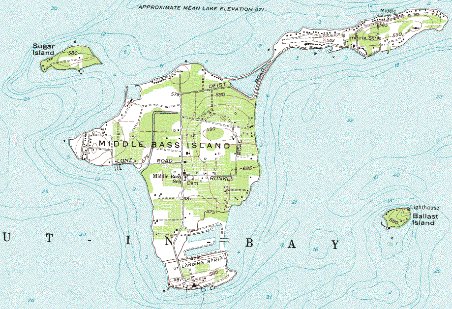
Note: The labels of Lonz Rd. and Runkle
Rd. are switched in the topo map below.
 By clicking on the logo on the
left, you can also get latitude and longitude for any spot on the island
By clicking on the logo on the
left, you can also get latitude and longitude for any spot on the island
All Contents Copyright © 2000-2004 by Middle Bass on the Web, Inc. All rights reserved.
Reproduction without written permission is forbidden for any purposes other than personal use.
Revised:
21 Jul 2008 07:49:53.

This page has been accessed times